
Busan · Running routes
Every good Busan run hugs the coast. Start with Gwangalli to Haeundae, or take the flat old rail line and ride the train back.
The 2026 Busan Sea Marathon (October 25) has passed. The coastal routes below are public paths you can run any time.
- Signature route
- Gwangalli → Marine City → Dongbaek Island → Haeundae, ~8 km (5.0 mi)Subway at both ends
- Flat and easy
- Mipo → Songjeong Green Railway, 4.8 km (3.0 mi)
- Night runs
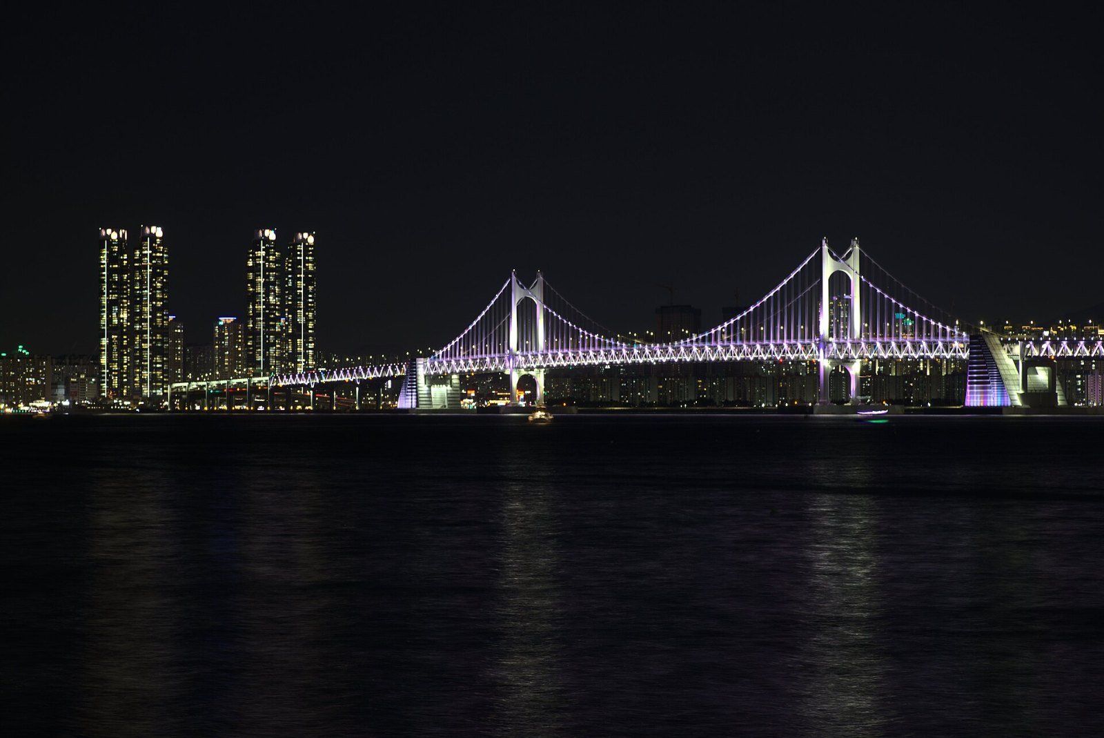
- LED-lit Marine City waterfront
- Race it
- Busan Sea Marathon, late OctoberStarts on the upper deck of Gwangalli Bridge
Seoul runners get a river; Busan runners get the sea. Busan’s eastern coast is one long, mostly connected promenade system — beaches, a reclaimed skyscraper waterfront, a pine island, and a converted railway squeezed between cliffs and surf. If you’re staying anywhere near Haeundae or Gwangalli, you can run a genuinely memorable route from your hotel door. These are the three worth planning around.
- Gwangalli to Haeundae — the signature coastal link
- Mipo to Songjeong — the Green Railway
- Igidae — the cliff trail
- Night running, and racing it instead
- FAQ
| Route | Distance | Terrain | Best for |
|---|---|---|---|
| Gwangalli → Haeundae | ~8 km (5.0 mi) one-way | Flat promenade, one hilly island loop | The one big Busan run |
| Mipo → Songjeong Green Railway | 4.8 km (3.0 mi) one-way | Flat, converted rail path | Easy scenic run, any level |
| Igidae Coastal Walk | 4.7 km (2.9 mi) one-way | Hilly trail, stairs | Trail-style workout, wild coast |
Gwangalli to Haeundae — the signature coastal link
- Distance: ~8 km (5.0 mi) point to point (shorter out-and-back options everywhere)
- Start: Gwangalli Beach (Gwangan Station, Line 2) → Finish: Haeundae Beach (Haeundae Station, Line 2)
- Surface: Paved beach promenades and waterfront walkways; the Dongbaek Island section is a paved park loop with gentle climbs
- Facilities: Restrooms, convenience stores and cafés along both beaches; the route is built up the whole way, never remote
Start on Gwangalli Beach with the full span of Gwangan Bridge in front of you, then follow the water east. The middle section is Marine City, Busan’s wall of residential towers on reclaimed land, where the waterfront promenade runs about 3 km under the skyscrapers — locals use it as their evening track, and the LED lighting keeps it bright and busy after dark. Then comes Dongbaek Island, a pine-covered park loop of about 2 km past the Nurimaru APEC House, and you spill out onto Haeundae Beach itself, 1.5 km of sand-side promenade to finish.
Why this order and not the reverse: the bridge view opens the run instead of closing it, Marine City’s towers light up as you pass if you start near sunset, and Haeundae’s café strip is the better place to end up sweaty and hungry. Short on time? The Gwangalli → Marine City out-and-back (about 6 km) is the highlight reel.

Mipo to Songjeong — the Green Railway
- Distance: 4.8 km (3.0 mi) one-way
- Start: Mipo, at the eastern end of Haeundae Beach → Finish: Songjeong Beach
- Surface: Flat paved path on a decommissioned railway — the gentlest gradient in Busan
- Facilities: Cafés at Cheongsapo (midpoint fishing village); Songjeong Station (Donghae Line) for the ride back
When the Busan section of the coastal railway closed, the track bed became a walking and running path — and because trains hate hills, you get 4.8 km of near-perfect flat running pinned between pine trees and the East Sea. You pass through old rail tunnels, stop for coffee in Cheongsapo (look for the twin lighthouses), and finish on Songjeong Beach, Busan’s surf beach. Run it one-way and take a bus or the Donghae Line train back from Songjeong (the tourist Haeundae Beach Train is a paid ride, about ₩10,000 one-way) — or turn around for a 9.6 km (6.0 mi) long run.
One warning: the path is shared with the Haeundae Blueline Park’s tourist foot traffic, and the Cheongsapo stretch gets crowded on weekend afternoons. Run it before 9 a.m. and it feels like your private coast.
Igidae — the cliff trail
- Distance: 4.7 km (2.9 mi) one-way
- Start: Igidae Dongsaengmal → Finish: Oryukdo Sunrise Park (Oryukdo Skywalk)
- Surface: Mixed pavement and dirt trail, with steep sections and lots of stairs — a trail run, not a promenade
- Facilities: Trail map at the entrance; bus access at both ends; plan water accordingly — this is the one route here that leaves the city behind
South of Gwangalli, the coast stops being a beach and becomes cliffs. The Igidae Coastal Walk threads along them for 4.7 km, with the Gwangalli Bridge framed behind you and Oryukdo’s islets ahead. It’s the wildest running close to central Busan — part workout, part hike — and the honest choice if promenades bore you. Save it for a cool morning; the stairs near the Skywalk end will find any weakness in your legs.
Night running, and racing it instead
Night is Busan’s home advantage. The beaches and the Marine City waterfront are lit, populated and café-lined until late, and the bridge-and-towers skyline is the city’s postcard. A sunset start from Gwangalli gets you the golden hour on the beach and the lights coming on as you reach Marine City — if you run one evening in Korea, make it this coast. Standard big-city sense applies (stay on the lit promenades, watch for delivery scooters near café strips), but nothing about these routes closes at dark.
Want a bib instead? The Busan Sea Marathon (부산바다마라톤) runs in late October — October 25 in 2026 — gathering at the BEXCO plaza and starting on the upper deck of Gwangalli Bridge, normally closed to pedestrians. Distances are 15K (₩70,000, about $50), 10K (₩60,000, about $43) and 5K (₩50,000, about $36) for 12,000 runners — and entries sold out within days in 2026, so this is a set-an-alarm race, not a show-up race. A full marathon joins the calendar on December 6, 2026, with the new Busan Bridge Marathon.
And one city over: the Gyeongju International Marathon runs in mid-October (October 17 in 2026, about 20,000 runners, full/half/10K with an English website). It’s an easy pairing with a Gyeongju sightseeing trip — race in the morning, 1,300-year-old tombs in the afternoon.
Practical Info
Stops and starting points
Show this in Korean
Tap Naver for walking directions: Google Maps in Korea shows places and transit routes but not walking directions yet.
FAQ
Which Busan route is best for a beginner?
The Green Railway from Mipo to Songjeong. It’s flat by construction (it’s a railway), scenic the whole way, and the train back removes any pressure to save energy for the return trip.
Can I run on the beaches themselves?
The promenades beside the sand are the running surface — wide, paved, and continuous. The sand itself is soft and slow; fine for a barefoot shakeout at Haeundae, miserable for a workout. Swimming-season crowds (July–August) also make the beachfront paths slow going at midday.
Is it safe to run Busan’s coast early in the morning?
Yes — dawn is when the local running crews are out, especially around Haeundae and Gwangalli, and the promenades are never fully deserted. The Igidae cliffs are the exception: save those for full daylight.
How do I fit a run into a short Busan trip?
Pick one sunrise run on the Gwangalli → Marine City section and keep the rest of the day for sightseeing. Our Busan 2–3 day itinerary shows where a morning run slots in without costing you the markets and temples. For the day-trip version, Gyeongju pairs naturally — see our Gyeongju day trip guide from Busan, and time it with the October marathon if you can.
Practical last word: Busan’s coast is easy to follow, but the junctions through Marine City and around Cheongsapo are where visitors take wrong turns — pin the route in Naver Map before you set off, using our guide to Naver Map in English. This is part two of our Running in Korea series; part one covers running in Seoul, where the Han River does the job Busan’s sea does here.
5 thoughts on “Running in Busan: Coastal Routes Worth the Trip Alone”