
Seoul · Running routes
Seoul’s default run is the Han River: flat, lit and a subway ride away. Want hills without traffic? Run the Namsan loop.
- Han River
- Yeouido or Banpo: an easy 5 km (3.1 mi)
- Namsan loop
- ~7.5 km (4.7 mi), paths closed to cars
- Lockers
- Runner Station at Yeouinaru; free Runners’ Bases in three subway stations
- Before a hard run
- Check the fine-dust (AQI) forecast
Seoul looks like a hard city to run in — all towers and traffic. It’s actually one of Asia’s easiest running cities, because the locals run a lot (the government put locker rooms for runners inside subway stations), and the best routes sit exactly where you’re already sightseeing. These five are the ones Seoul runners genuinely train on, each with the practical details a listicle usually skips: where to start, what’s under your feet, and where to stash your bag.
- Yeouido Hangang — the default 5K
- Banpo Hangang — the evening run
- Namsan — the car-free hill loop
- Cheonggyecheon — the downtown dash
- Olympic Park — pick-a-distance lanes
- Before you run: lockers, air, winter
- FAQ
| Route | Distance | Terrain | Best for |
|---|---|---|---|
| Yeouido Hangang | 5 km (3.1 mi) loop | Flat, paved | First run in Seoul |
| Banpo Hangang | ~5 km (3.1 mi) out-and-back | Flat, paved | Evening / sunset run |
| Namsan Dullegil | ~7.5 km (4.7 mi) loop | Hilly, paved, car-free | Hill training, views |
| Cheonggyecheon | 5.8 km (3.6 mi) one-way | Flat, paved, below street level | Downtown sightseeing run |
| Olympic Park | 1.3–4.3 km (0.8–2.7 mi) lanes | Rolling, paved | Structured workouts |
Yeouido Hangang — the default 5K
- Distance: 5 km (3.1 mi) loop
- Start: Yeouinaru Station (Line 5), exits toward Hangang Park
- Surface: Flat paved riverside path, separate bike lane
- Facilities: Runner Station inside the station (lockers, route boards); restrooms and convenience stores in the park
If you run one route in Seoul, run this one. The standard loop starts near the Hangang Event Plaza, passes the National Assembly and comes back along the river — a clean 5 km with skyline views the whole way. It’s also the most runner-ready spot in the city: Seoul built a Runner Station into Yeouinaru Station itself, with lockers, changing rooms and an info board for weather and local running events, so you can arrive in street clothes, stash your bag, and be on the path in minutes.
Go early or after dark. Midday weekends here are picnic territory — beautiful, but you’ll be weaving around picnic mats and delivery scooters. (Yes, fried chicken gets delivered to the park. This is Korea.)
Banpo Hangang — the evening run
- Distance: ~5 km (3.1 mi) out-and-back
- Start: Banpo Hangang Park parking lot, or Some Sevit (세빛섬) floating islands
- Surface: Flat paved riverside path
- Facilities: Restrooms and a convenience store at Some Sevit; subway access via Express Bus Terminal / Dongjak stations (Lines 3·4·9 area)
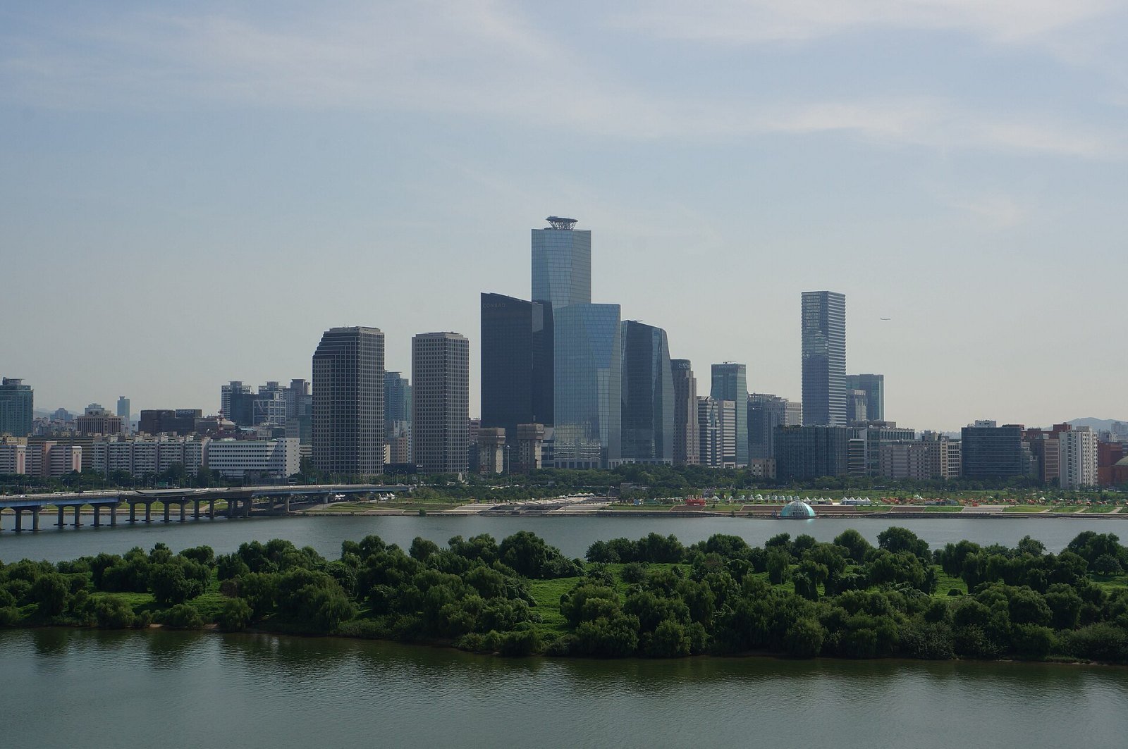
Banpo is Yeouido’s prettier evening sibling. The simple version: start at the park, run under Banpo Bridge toward Hangang Bridge and back — about 5 km, all flat. Time it for dusk and you get the Banpo Bridge Moonlight Rainbow Fountain, water arcing off the bridge in shifting colors, as your turnaround reward. A loop starting and ending at Some Sevit, the floating islands, makes a good base because the restrooms and convenience store are right there.
Local color: this stretch is a known celebrity jogging path — marathon-obsessed singer Sean is a regular, and he hosts a New Year’s Day run here. If the riverside path feels busy on a weekend evening, that’s why.
Namsan — the car-free hill loop
- Distance: ~7.5 km (4.7 mi) loop (Namsan Dullegil); ~10 km of paved paths on the mountain in total
- Start: Hoehyeon Station (Line 4), or Myeongdong side
- Surface: Paved, genuinely hilly — this is a small mountain
- Facilities: Runners’ Base inside Hoehyeon Station (free lockers, changing rooms — see below)
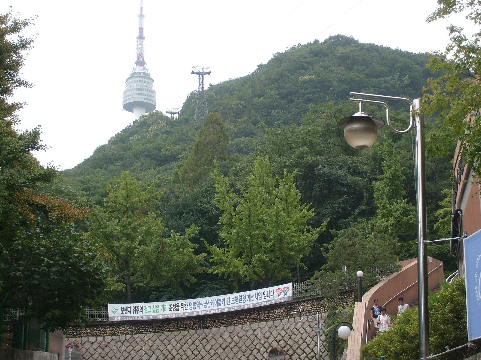
Namsan (남산, “South Mountain”) is the green lump in the center of Seoul with the N Seoul Tower on top — and its ring road is the city’s best hill workout. The wide northern circuit road is a car-free walking path, and Seoul city puts the full Dullegil trail at about 7.5 km, so the loop gives you roughly 7.5 km of climbing and descending through pine forest without dodging traffic. The trade-off is real elevation: treat it as a strength session, not an easy day.
Detour worth it: branch up toward the tower plaza at least once. The view over the city you just ran around is the best free panorama in central Seoul.
Cheonggyecheon — the downtown dash
- Distance: 5.8 km (3.6 mi) one-way, point to point
- Start: Cheonggye Plaza, near Gwanghwamun / City Hall stations
- Surface: Flat paved banks, set below street level
- Facilities: Stairs up to street level every few hundred meters; cafés and convenience stores at street level
Cheonggyecheon (청계천) is a restored stream running 5.8 km through downtown, and its trick is altitude: the path sits below street level, so you run under 22 bridges with no traffic lights, no crossings, no cars — past Gwangjang Market and Dongdaemun as you go. It’s the only run in Seoul that doubles as a sightseeing route through the historic center.
Two runner’s caveats. The banks are popular with strollers, so run it early morning for a clear path. And it’s point-to-point: finish at the eastern end and ride the subway back, or turn around at a bridge for exactly the distance you want.
Olympic Park — pick-a-distance lanes
- Distance: Five official lanes from 1.3 km (0.8 mi) to 4.3 km (2.7 mi); full park loop ~5 km (3.1 mi)
- Start: Mongchontoseong Station (Line 8) or Olympic Park Station (Lines 5·9)
- Surface: Paved park paths, some rolling hills
- Facilities: Lockers at both subway stations; cafés at the plazas
The 1988 Olympic Park is where Seoul’s structured trainers go. The park marks out five named lanes around the old Mongchon fortress: Lakeside Lane (1.3 km), Fortress Lane (2.2 km, hilly), Youth Lane (3.1 km, the outer ring used for running events), Memory Lane (3.5 km) and Lovers’ Lane (4.3 km). Pick one, stack two, or run the full loop — the English-speaking Seoul Flyers running club trains here and publishes route files, which tells you this is a real training ground, not a photo stop.
Photo detour: the Lone Tree (나홀로나무) on the grass hill is the park’s famous landmark. Everyone stops. You will too.
Before you run: lockers, air, winter
Bag storage. Beyond Yeouinaru’s Runner Station, Seoul Metro opened free Runners’ Bases at Gwanghwamun (Line 5), Hoehyeon (Line 4) and World Cup Stadium (Line 6) stations — changing rooms, lockers and powder rooms, open 05:30–23:00. Entry is by Naver QR or KakaoTalk authentication and lockers run through Seoul Metro’s Ttota Locker app, so if you don’t have Korean app accounts, the staffed station lockers (also app-based) or your hotel are the fallback. Regular coin/app lockers exist in most major stations.
Air quality. Korea’s spring fine-dust (미세먼지) season is the one real weather trap. Check the day’s AQI before a hard workout; on a “bad” (나쁨) or worse day, shorten the run, slow down, or swap in a rest day. Summer’s trap is different: heat and humidity from late June to August make early morning the only sensible slot.
Winter. From December to February, riverside paths get sub-zero wind chill and can ice over after snow. The routes above stay open, but treat shaded riverside corners like ice rinks and layer for wind, not just temperature.
Finding people. Running crews (러닝크루) are a whole culture here, and many welcome guests. Seoul Flyers is the easiest English-language door in; city-run programs at the Runner Station and Runners’ Bases are free. Show up, say you’re visiting, and you’ll usually be adopted for the morning.
Practical Info
Stops and starting points
Show this in Korean
Tap Naver for walking directions: Google Maps in Korea shows places and transit routes but not walking directions yet.
FAQ
Can I run along the Han River at night?
Yes — the main Hangang parks are lit and busy well into the evening, and Banpo is specifically an evening route (the bridge fountain is the point). Paths stay open around the clock; just expect the last stretch after midnight to be quiet rather than dangerous.
Where do I leave my bag if my hotel is across town?
Use the Runner Station at Yeouinaru or a Runners’ Base (Gwanghwamun, Hoehyeon, World Cup Stadium) — both are inside subway stations and built for exactly this. If the app-based entry doesn’t work with your accounts, major stations also have standalone lockers.
Which route is best near Myeongdong?
Namsan. Hoehyeon Station is one stop from Myeongdong, the Runners’ Base is right there, and the loop starts climbing almost immediately. Cheonggyecheon is the flat alternative, a short walk north.
What’s the best season to run in Seoul?
Autumn (late September to November) and late spring. Autumn gets you cool air, clear skies and the city’s big race season — the JTBC Seoul Marathon runs in early November. Spring is lovely but watch the fine-dust forecast.
Two things make all of this easier on the ground. First, navigation: Korean addresses and park entrances make far more sense in Naver Map than in Google Maps here, and our guide to using Naver Map in English walks through it. Second, if your run turns into a gear-shopping trip (Seoul’s running stores are excellent), our Korea tax refund guide covers getting the tax back at checkout. And when you’re ready for salt air instead of river air, the series continues with running in Busan — three coastal routes where the whole city seems designed for a sunrise run.
2 thoughts on “Running in Seoul: 5 Routes Where Locals Actually Train”